



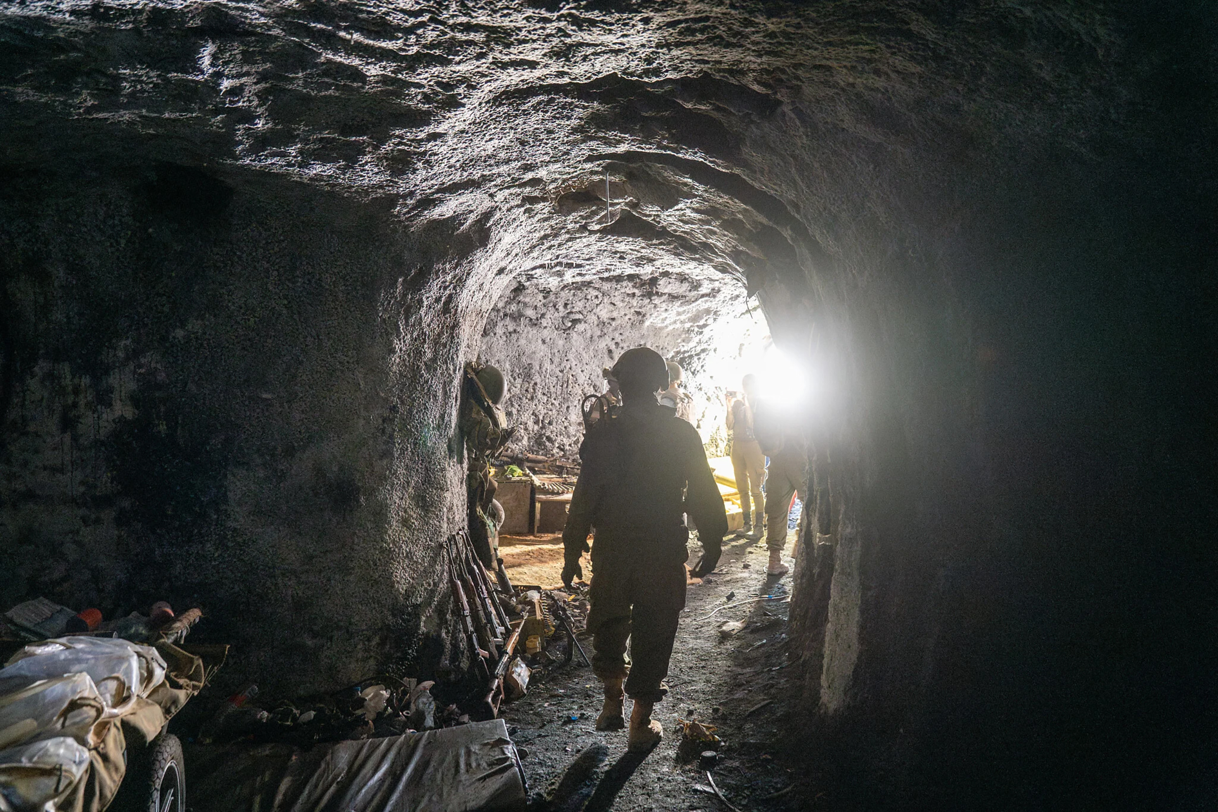
For many years, the residents of Israel’s Galilee Panhandle looked across the ridge and saw little more than rolling green hills, quiet Lebanese villages and homes that seemed almost idyllic. But behind the quiet facade of these communities, one of the most sophisticated terror networks Hezbollah ever built in southern Lebanon was taking shape. Underneath residential homes, schools, public buildings and shops, tunnels were being dug, command rooms were being established, missiles were being stored and elite forces were being trained for the organization’s flagship mission: infiltrating the communities of northern Israel.
The most dangerous of these villages was Khiam. Situated in the eastern sector of southern Lebanon, the town dominates the Marjayoun Valley and commands an almost uninterrupted view. From the rooftops of its homes, one can clearly see Metula, Kfar Yuval, Kibbutz Dan, Kibbutz Dafna and even Kiryat Shmona. Located barely five kilometers from the Israeli border, Khiam became one of Hezbollah’s most valuable strategic assets. Over the years, the organization poured enormous Iranian resources into transforming it into a military fortress, investing heavily in advanced weaponry, trained manpower and an elaborate defensive network.
Khiam became one of Hezbollah’s principal centers of influence in the region, and they used its rooftops to deploy anti-tank missile launchers, including Kornet missiles, aimed directly at the homes of Metula’s residents. The relentless fire inflicted devastating damage on the community; nearly 70% of Metula’s buildings were struck by rockets or missiles in the recent war.
Today, I am joining a group of photographers and fellow journalists in a staging area outside Kiryat Shmona. The officer leading the mission studies our faces and reminds us that even when the area appears calm, appearances can be dangerously deceptive. “Things are relatively quiet at the moment,” he tells us. “But it is that word—‘relatively’—that should concern you. Stay alert. If there’s a security incident or a drone is launched toward us, we’ll work together with the forces on the ground to protect everyone.”
His words are delivered almost matter-of-factly, but they instantly change the mood. Everyone understands that this is no routine press tour. We are entering territory where the war has yet to truly end, where its presence is still etched into every shattered wall and ruined building.
Shortly before noon, the heavy doors of our armored vehicle swing shut with a metallic thud that echoes through the cabin. Packed tightly together and covered in protective gear from head to toe, we begin the drive north. We travel along the northern highway, pass through the orchards and approach Israel’s northernmost border crossing. A few minutes later, a big yellow gate comes into view. IDF soldiers inspect our permits, exchange a few brief words with the driver, and the gate slowly swings open.
The crossing that was once little more than a heavily fortified checkpoint surrounded by towering concrete barriers has become a bustling military hub, filled with soldiers, armored vehicles and engineering equipment. It now serves as the primary gateway into the newly established security zone inside Lebanon, leading toward the Beaufort outpost and the ridge overlooking Metula. Within moments, the smooth black asphalt gives way to a rugged military track that jolts the vehicle violently as we leave Israel behind and enter the fields opposite Metula. For years this landscape was viewed only from observation posts across the border. Now we are driving through it.
We pass the abandoned British airfield, constructed during the Second World War after British forces seized Lebanon from Vichy France, whose collaborationist government had aligned itself with Nazi Germany. Fearing an invasion from the north, the British established this landing strip deep in the valley. The surrounding fields, where Jewish feet hadn’t walked for decades, include agricultural lands belonging to the farmers of Metula, properties that remain registered in the Ottoman land registry in Sidon. Under the Paulet-Newcombe Agreement between Britain and France, they were transferred to French-controlled Lebanon. After the founding of the State of Israel, farmers were barred from accessing them to keep them out of harm’s way.
The convoy continues toward the headwaters of the Jordan, passing the canal and dam controlling the Hasbani River before beginning the steep ascent up the ridge overlooking Metula. The road is little more than a maze of rocks, craters and deep ruts, but the convoy presses ahead at remarkable speed. In terrain like this, the defining skill of a military driver isn’t simply the ability to navigate difficult roads but to do so quickly. Even now, after Israeli forces have captured the ridge, no one knows where the next anti-tank missile or explosive-laden drone may suddenly appear.
Along the route, villages that took heavy hits during the war come into view. Some homes have been completely reduced to rubble, while others remain occupied by IDF troops. Caterpillar D9 bulldozers, excavators and other heavy engineering vehicles operate almost continuously, widening roads, carving new routes through the hills and constructing defensive embankments. These are all part of the ongoing effort to secure the area permanently and prevent Hezbollah from ever returning to the positions from where it threatened northern Israel for so many years.
To read more, subscribe to Ami